Geofumadas on the fly, January 2009
Gentlemen, these days are running; between finishing the operational plan for this year, liquidating balances of q What happened and socializing with mayors the scope of what implies the agreement of cadastral values in a political year ... ugh!
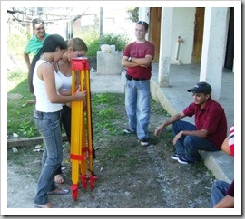
Getting ready to replicate the course of Total station; By the way, when I see in the report pictures how I understand why many almost cried because I left them out of the previous day.
In the meantime, here are some interesting links for those who like good readings and high-level geofumadas.
good smokes
 stereowebmap, apparently stereoscopic vision on the web; Very interesting, I am still cracking as they have achieved.
 Geo without entanglements, Guide in Spanish of PostgreSQL, PostGIS, MapServer, PHPMapScript written by Andrés Herrera. By the way add to your reader this blog, a lot of interesting content.
 Remote Sensing Forum, an initiative of Oscar Arostegui. We hope that it will grow and that it does not get so many gray hair from being on the moderator's side ... which implies a lot of patience with all kinds of users.
 Ten predictions for 2009, interesting topic of what we could expect this year in geospatial matters.
 Guatemala is innovating, having the first public park with free wireless internet; you just have to think about security because for a thief it is the perfect place to get technological toys.
 What happens in the forums
- Gabriel Ortiz reactivate file sharing option
- Cartesia Forum, Import a .kmz route to the GPS Garmin nuvi
 About AutoCAD and other perverse software
- AutoCAD extension to see large files in Google Earth
- Convert wms services one kml
- What can we expect from ArcGIS 9.3.1
- Run AutoCAD on a mac
 About web mapping
- Placeopedia, geo-referenced wikipedia
- Automating google earth cache
- Google Transit in 50 cities
- inserting Open Street Map inside a post


Surely you can use it. Very good group eh, by the way I have joined.
Hi, interesnates the links. Can I use the image to put it in a facebook group? (I was funny, hehe, reminds me the first day we took a theodolite xD)
http://www.facebook.com/login.php
TOPOGRAPHY .... IMAGES ONLY