
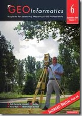
Geoinformatics 6, much for surveyors
 The new edition of Geoinformatics with the date September
 2007 2008.
Let's briefly see several interesting topics; although I recommend that you read the online version that in 84 pages is worth digesting with time, you can also download it as pdf although it weighs as 19 MB.
Topography Approach
That is the name of the editorial of Eric van Rees who, after attending the ESRI conference in San Diego, was expected to dedicate more than half a page; On the contrary, he seems stuck in the Topo's roll, it is shown on the cover and much of the content.
Topcon IS-03 Review
 This is an article that apparently is the first in a series of reviews that will make robotic total stations; In this case the Topcon IS-03.
The revision is based on: What type of user documentation, general appearance, how friendly is its use, file handling and field work capacity.
It is one of the topics that have attracted me most, especially because it is a collectible series if they are going to continue with other teams of other brands; The journal also reviews Hemisphere XF101 and Archer which are mobile capture technologies.
Short columns:
CityGML; Smart 3D, presented by Sam Bacharach of the OGC
Enabling GeoWeb, By James Fee
Other reviews and topics:
The Double Difference ... The RTK service providers, and what discontinuation entails following the Galileo data.
The measurement in the distance, an article that asks where the biggest suppliers of technological products in the topography are walking: Trimble, Pentax, Leica, Magellan, Sokkia,
The next generation of capture technologies Lasser.  To this, I recommend you take a direct look.
Interview with geokosmos, After the Beijing ISPRS congress
 Interview with Geomax, Topographic instruments of high productivity
Coastal topography techniques
Geolocation Based on services
But man, if with these tips you don't go directly there ... I don't know what else a magazine can bring.


could you tell me which trimble or topcon gps do not use cables to connect to the radio, something like bluetooth
: )
With September 2007? Maybe 2008.