
Georeferencing an image with AutoCAD
In another post we talked about georeferencing scanned maps or Google Earth images, we saw how to do it With Manifold y With Microstation, in these entries you can see more details of how to get the Google Earth image, the utm coordinates and how to cut them.
Now let's see how to georeference the image with AutoCAD
1. Entering the coordinates
To enter the UTM coordinates in AutoCAD, it is done with the point command. (Drawing / point / multiple point)
Then enter the coordinates of this form:
From the command bar would be:
point, enter, coordinate, enter, coordinate, enter ... until you enter all of them.
The coordinate format is: "coordinate x" , "coordinate y", so that they would be
431512,1597077
431838,1597077
431511,1596838
431837,1596838
If the system does not accept them, it may be because the configuration of points management is not according to the format, so write on the command line PDMODE = 2
If you don't see the dots or they look very small, select format / point styles / and choose a more visible format.
You can also Import from excel
Entering the points should look like this:

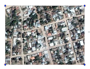
Now what we must do is insert the image, this is done with “insert/image manager”

We click on the button “attach“, then the image is searched and you indicate that the insertion point and scale will activate it on the screen.
Then select the left corner, with the snap on the point, and the lower right.
Ready, the image is georeferenced to the specified coordinates.
2 How accurate are Google Earth data for cadastre?
Do not use this for serious work, because that does not serve GoogleEarth data. Previously we had talked about thePrecisions” that have the Google Earth data.


Thanks for the data. Very interesting
EXCELLENT THANK YOU VERY MUCH
I found a utility to georeference images in AutoCad that have their corresponding “world” file:
GeoRefImg new Repositions georeferenced raster images automatically according to their World files (VLX for AutoCAD 2004 / 2005 / 2006, 2007 / 2008 and ADT)
http://www.cadstudio.cz/en/download.asp?file=GeoRefImg
Hello! Thank you very much! You do not know how I appreciate it.
A greeting!
Hi Ruth, to capture the image there are some tools and also you can do to pure printscreen check those post.
capturar In mosaic
with Arc2earth
with AutoCAD
Also in these post I speak as it can be georeferenced In aggis
And above all I recommend that you see a post Favorite topics Where there are several ways to download, upload and georeference
Hello ... .. and do you know how to take that image from GoogleEarth and georeference it in ARcGis? You would be of great help if you give me a hint.
All the best
Hello, thank you, it is very helpful, I thank you for uploading this information to the internet and if you have more on this topic, please send it to me, thank you….