
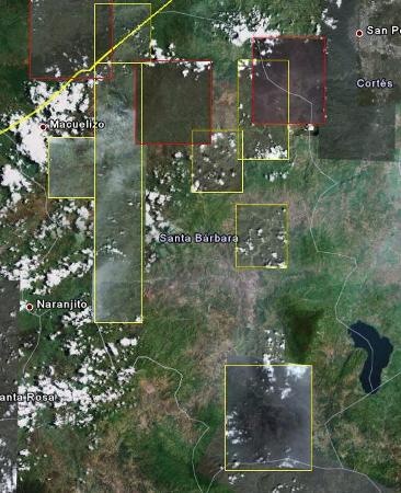
Google Maps from the Mobile Mapper 6
And to think that my technicians walked these toys almost a year, To finish saying to me that they did not understand to him and that they preferred to stay with the Pro. Well, let's find a way to use a couple of GPS Mobile Mapper 6, which I hope to put to work with a base Promark 3 and post-processing with Mobile Mapper Office.
Without post-processing, this computer is like any browser. With post-processing He wins until A Juno SC from Trimble.
 Just to bite them, we'll try connecting them to Google Maps, using the readme that Jonathan Draffan made from April last year.
Connect to the Internet
The MobileMapper 6 brings three ways to connect to the Internet:
- Bluetooth, which is the most practical as it can be done via the mobile phone or as some still call it, the cellular.
- Connected with USB to a PC that has Internet access, via Activesync. This can be a Netbook, one of those 300 dollars, and an Alcatel-type USB modem, a service now provided by most telephone companies.
- I think you have another one with a VPN connection but I have no idea how it works. A pity that these toys do not include another type of wireless connection, such as that which can be used with a wireless modem.
Download Google Maps
 For this, go to Google's mobile resources, on page http://m.google.com. The system automatically recognizes that you are connecting from Windows mobile, and the option to download it appears.
It asks a couple of times to authorize the download and installation, but in less than a minute it is installed. It is possible to activate or deactivate layers such as:
- Satelital image
- Google Latitude
- Traffic
- Buzz
- My Maps
- Wikipedia
- Lines of transport
Activate the GPS.
 For this, it should only be done from the menu: Options> activate GPS.
To configure it, it is done in Options> Configure GPS. You can leave the Windows Managed alternative, but you may get better results if a specific port is enabled.
We will use COM1 and 9600.
Surprising, with the blue button in the corner, you click and it takes you right to the position you are, with a transparent wheel of the possible precision error that decreases as more satellites are seen. At first it falls almost on my office, with the satellites that it receives from the clarity of the window but with a while of having it static you can see how it begins to turn trying to give a better position, in a range of up to 20 meters.
The number of satellites you are viewing is shown at the top right. Very practical to go in the car, we will see what happens when post-processing the captured data.


No. Mobilemapper 6 can not be used as a basis.
Hi, if I had two gps mobilemapper6, could I use one as a base and another to take data?
which is an assisted GPS, has the same precision as the 6 mobile mapper. Thank you
With the Ashtech or Topcom distributor in your country.
Could you tell me where they could give me the activation code of a movile mapper 6 was lost and I do not have the code, thanks
You do not clarify if you have them in separate columns, so you would have to see if you need to concatenate them.
Mira this link:
Eye, that you will have to adjust the format of decimals, so that AutoCAD does not misunderstand you those separators of thousands. You change that in the regional settings of the Windows control panel.
Good afternoon:
I have these coordinates in excel, and I need to pass them to AUTOCAD as a polyline and I do not know how to do them by favpr someone to help me THANKS
COORD X MAGNA COORD AND MAGNA
781.226,87 696.972,52
782.098,45 697.680,20
782.098,45 697.680,20
781.278,65 697.032,19
781.376,36 697.144,70
781.376,36 697.144,70
782.005,90 697.586,35
782.098,45 697.680,20
781.577,82 697.328,29
782.005,90 697.586,35
782.005,90 697.586,35
782.005,90 697.586,35
782.005,90 697.586,35
782.005,90 697.586,35
782.005,90 697.586,35
782.098,45 697.680,20
782.070,37 697.651,59
782.143,03 697.724,21
782.221,09 697.797,72
782.370,62 697.947,72
I do not know which manual you've seen, This is the one i know.
The order In brief is
-Go to the mobile mapping program
-Create the configurations of your zone
-Create the .map file that will contain the layers
-Create the shp layers where you will store the data (plots, streets, signs, etc.)
- Capture data in the layer of interest.
-Download data
Mobile mapping is the program that brings the Mobile Mapper, can create .map and .shp files, does not have many features other than data capture. If you want to read other things about the captured information, you must download the shp layers and analyze them with a CAD or GIS program.
Another option is to use another paid program such as ArcPad or Cartopad which may have more functionality.
You increase its accuracy by postprocessing the data against another base, you occupy the program Mobile Mapper Office, Once installed low the points and the one in charge to look for bases near if the computer is connected to Internet.
That would make the data raised have better accuracy.
very good day sir geo .. I want to know the procedure to do a topo survey .. with a mapper 6 the manual only brings the basics but I could not find the exact operation that is, mark points, read their azimuth, their coordinates, their convergence ... and perhaps I will be able to do it with a single team without having one as a base ... I thank you in advance for your attention ...
Hi, I have 2 mobile mapper 6, but I know they have some degree of error, how do I increase their accuracy ?, I need some additional software ??
Remember that the point obtained in the field has an error without post processing of about 2.50 meters. Once postprocessed you will get an error of about 1.00 meters.
Get the idea, that your first point is anywhere in a circle of 5 meters in diameter. The second a circle of 2 meters in diameter.
When you go to the field again, your point will be anywhere in the same circle.
Look I have the mobile mapper 6 even without prosproceso my question is if when you get points of a land and after days return to the same land will have the same points? And what presicion would get already with the postprocess? And if already in the postprocess get points and return to field would get the same points? If you can answer me I would be very grateful
It is not a matter of limitations, but of utility and type of associated data.
For example, you can have a layer of plots, this will be a polygon type, but if you want to register also the business will be another layer and in this case will be points, if you want to register toilet train routes will occupy a new layer of type linestring.
That is the sense of having different layers.
To create background maps you must use the Mobile Mapper Office:
tools> background maps
Here you add the vector or raster layers that you expect the background map to have, once you have it ready you upload it to the gps using
file> upload to gps> background map
hello I wanted to know what is what limits a layer if the geographical aria or the number of entities that I can register for each layer. or in other words when I use another layer, at some point my gps will tell me that I can not register an entity in a layer; I have this doubt and the manual does not clarify it, it just says that I can create new layers and I want to see where I can get a background map.
Do you speak of a map of the international boundary of Costa Rica?
What did you crumble?
I have a Magellan in Costa Rica, I've already managed to “unravel” a map of the country from a Garmin; now I need to mount it on a background map via Mobile Mapper 3.4 or 2.7 software; but I've gone crazy trying to find it online. You don't know where I can get it.
Thank you,
It should be visualized. Try changing the format of points, because in AutoCAD the default format is a few dots that can hardly be seen.
hi buy the previous version to mobile mapper oficce 6 and if you are right you have the tool to export the files shp to dxf. I use the tool and I create a dxf file but when I want to visualize it with auto cad I can not see it. because it will not be displayed as it is displayed in mobile mapper ofice. I created the file when I use the tool but when I use car cad I can not see it.
Thanks for the clarification, I think it's very clear, thank you very much
I see the confusion. You will always need what you measure using a snap tool, unfortunately that does not have Google Earth and the measures you do are approximate to what your eye sees and your mouse can reach, it is also affected by the approach you have. Neither for this is the Mobile Mapper Office 6 very good.
Google Earth is to visualize data, Mobile Mapper Office is to visualize and postprocess data. But nothing of what you measure there is precise because these programs are for that.
To do editing work, measurement, a course and distance chart, etc, you must use Microstation, AutoCAD or gvSIG, which have snap topological options. I guarantee that the measure will not be the same as what Google Earth and Mobile Mapper Office give you, but it will be the precise measure (of measurement, not of reality in the field).
I should also clarify that is not the same the “Mobile Mapper 6 Office” program that comes with the new MM6 devices than the “Mobile Mapper Office” that was sold before with the previous devices. The first one had capabilities to export to dxf so that you could work with the files with a CAD program.
well if the truth is that I was not clear, my question is the following one hundred forty points with a gps mobile mapper. these points the arratre to google earth and I could see take the distances between point and point with the tool of google that allows to do this. Then I was able to get the office mobile mapper 6 ofice that also allows me to open the points and measure the distances between point and point. and it turns out that the distances that I measure with the gps office vary in one or two meters for each measurement in relation to the measures with the google eart program. My question is which of these measurements are more reliable. you imagine that I could load these points in autocad and at the time of measuring the distances between point and point I would give other measurements. which would be the most reliable of all.
Answering your different questions:
>> It depends on the source of the images, many of Europe and the United States are very precise but in Hispanic countries they have displacements of up to 30 meters. A Mobile Mapper without postprocessing gives a precision of 2.50 meters, and postprocessing near the subway.
>> I do not understand your other question. Mobile Mapper Office is the software you use to do post-processing, it's not a computer.
>> You can put on Mobile Mapper any program that runs on Windows Mobile, such as ArcPad, Excel, Word, PowerPoint, etc.
>> Mobile Mapper Office (the program) allows you to export data to dxf, and you can see them with AutoCAD.
Which medicon is more accurate one made with google eart or one made with mobile mapper ofice
hello because I can not mark routes with the points that I import from the gps to mobile maper office but only with the points that I frame from this
I can import points from mobile mapper office to autocad
hello that other programs I can install to my gps mobile mapper
Hello google maps from mobile mapping 6 can be used in any country.
HELLO COULD MAKE THE INQUIRY IF ANY PERZONAS HAVING THE MM6 ME CAN SEND THE MOBILE MAPPER OFICCE TO MY MAIL IS THAT TO ME SALIO DAMAGED THE CD AND I HAVE SOME RECORDS OF A georeferencing of a transmission line IN THE APPLIANCE BUT NOT I CAN SEE NOTHING WITHOUT THE OFFICE.
HELLO thanks for giving COREEO OF DANIEL AND send you the user manual in PDF
Daniel's Mail
Hernandezda@ldschurch.org
Hello daniel it's relatively easy if you give me your email and I'll send you some information so you can get some information
I just bought the MM6. I have not been able to calibrate the compass, I have tried more than 20 times, any recommendations?
I still do not understand how to use the appliance. I buy it to lift points, traverse and routes. Anyone know or can you help me with some good tutorial?
Thank you.
Hello it has been impossible to download the mobile mapper 6 office from the address they gave me if someone has it would be so kind to share it with me I will be grateful my email is Raulartola1@gmail.com
It is not broken, what happens is that the url is poorly constructed.
Try this:
Ftp://ftp.promagellangps.com/
The software is separate, I understand. You can download it from the Internet, but the post-activation code should be purchased.
hello I want to know also if the purchase of the gps includes the office monile mapper 6 because I buy it here in Honduras and it turns out that the store that sold it to me now wants to sell me the office separately in 100 dollars
Hello the link is apparently fallen or does not exist but thank you for answering some other address where you can octener.
Sure, you can download it from Ashtech's page
Ftp://ftp.promagellangps.com/Mobile%20Mapping/MobileMapper%20Office/Software/
The Mobile Mapper 6 can connect to Google Maps using the Google application made to navigate from a mobile, but the Mobile Mapping Office, that I know can not manage kml layers or stick to Google Earth.
Hello I have a 6 mobile mapping gps but in the purchase I did not include the mobile mapper ofice disk my question is if I can download it for free from the internet or I have to buy it and my other question is that if I use the mobile mapping office 6 and google eart to create maps.
It is possible to download the data collected with a Mobilemapper 6 directly to any PC without special software.
Greetings and thanks.
It is excellent to have someone to solve your doubts.
Thank you
You have to do it slowly, on a flat surface, turning the equipment as you request it.
Hello, could someone help me? I can't activate the gps of my mobilemapper and when I want to calibrate the compass it sends me this message "the horizontal axis calibration failed please try again" I need help
Hello, could someone tell me how to solve the problem of loading shape file to mobilemaper 6 ,, matches the projections of the .map and shape file, but it still keeps showing me an error that the projections are not matches ,, I use the utm 15n in datum wgs84 ...
Hello good afternoon, I just bought a MM6 and I can not make it connect to my laptop, I already did the process as it marks the instructions, installing on mobile mapping and nothing, and probe uninstalled the mobile mapping, restart and nothing, update activesync And nothing, somebody can help me, porfavooorrrrr me uuuurgeeeeeee, my mail is century21mx @ hotmail, thank you for your support
Do not complicate yourself, use a GIS program. There are plenty of them and sooner or later you have to face them.
The version I have is the 1.0.1.1
And I can not find where to export to dxf
regards
Figal
Also as far as I can see, this software lets you export to dxf, although in doing this you will lose the data associated with the shp, which are stored in the dbf.
The data that the GPS Mobile Mapper, is in shp format, you can work with any CAD / GIS program like: AutoCAD, ArcView, Microstation, gvSIG, etc.
Mobile Mapper is not a GIS program, it is a program to postprocess GPS data, to give you better accuracy.
Ayjuesu !! That is serious
because it is supposed then that when I record a point "and at that moment that I am on site I have the coordinates on the screen" but
If I do not write them down in the notebook, I will not see them again until I process them
The shape?
And one more thing, in the mobile mapper office I see the field data on the screen, but how do I export or extract them to cad?
Or should I use an additional program to convert the shp to dxf?
Thanks in advance!
Regards!
I do not think so, you occupy the mobile mapper office or any other gis program with which you can see files type .shp
Thank you very much for answering!
but the question that hits me the most ...
If I am on the field raising some polygonal exis
And when I reach any internet cafe I want to see the coordinates
of the raised vertices, can I do it directly in the GPS?
Without the need for additional programs?
Regards!
Hello Fidencio.
When capturing data with your Mobile Mapper it was necessary that you create a project with .map extension, and also layers with extension .shp. In this post Is explained in detail.
To download this data, you take the SD card to the GPS, and place it on your PC, then download those files. Also via USB with ActiveSync.
To see that data, you use the Mobile Mapper Office software, which comes with the purchase of the GPS, if you are going to post-process them, that is Explained in this post.
If you only want to load them in AutoCAD, you must convert the shape files to dxf, that can be done with many programs.
Could you help me know how I can see coordinate information
of the points you take with a GPS Mobile Mapper 6
I need to draw this information in autocad.
Thank you!
Hello Mariano
The Mobile Mapper 6, without post processing is like any browser. The data runs between 3 and 5 radial meters.
It is best to buy them combined, such as a Promark3 and one or more Mobile Mapper 6.
The Promark uses it as a base, and with the other data takes, and in the end, post-processing using Mobile Mapper Office, using as reference what the Promark took while it was static, and give you precisions of less than one meter.
By the way, what country are you in?
I would like to know more about the 6 maper since it is intended to buy some for the office, work in catatsro without more for the moment a cordial greeting