
Search Results for: bentleymap
-
Cadastre

Access Oracle Spatial from BentleyMap
The following is an example of the functionalities that can be carried out using Microstation BentleyMap to manage information from an OracleSpatial database. Install Oracle Client You do not need to have Oracle installed on your computer. Only the Client,…
Read More » -
Geospatial - GIS

3 News and 21 important events in the GEO context - Starting 2019
Bentley, Leica and PlexEarth are among the most interesting novelties starting in February 2019. Additionally, we show that we have compiled 21 interesting events that are on the way, in which the entire community of professionals in the…
Read More » -
Geospatial - GIS

Bentley Systems makes a huge bet for the GIS when acquiring Agency9
Back in 2004, when Bentley incorporated XFM into its new V8i developments, Bentley had been integrating spatial functionalities that went from the Geographics legacy to Bentley Cadastre, PowerMap and BentleyMap. However, it had always been technology for engineering, which also did…
Read More » -
Featured

The SINAP National System of Property Administration
The National Property Administration System (SINAP) is a technological platform that integrates all the information related to the physical and regulatory resources of the nation, where the different public, private and individual actors record all the transactions…
Read More » -
Cadastre

Recommendations when implementing LADM
In several of the projects that I have participated in, I have witnessed that the confusion caused by LADM is not necessarily associated with understanding it as an ISO standard, but rather with isolating its conceptual scope of application from its mechanization scenario...
Read More » -
Cadastre

Migrating a Geospatial platform 10 years later - Microstation Geographics - Oracle Spatial
This is a common challenge for many Cadastre or Cartography projects, which in the 2000-2010 period integrated Microstation Geographics as a spatial data engine, considering reasons such as the following: Arc-node management was and continues to be extremely practical, for…
Read More » -
Featured

Alternatives to use QGIS on Android & iOS mobiles
QGIS has positioned itself as the fastest growing open source tool and sustainability strategy for geospatial use. We are pleased to know that mobile versions of QGIS already exist. The exponential use of mobile applications means that…
Read More » -
Geospatial - GIS

Open shp files with Google Earth
The version of Google Earth Pro stopped being paid for a long time ago, with which it is possible to open different GIS and Raster files directly from the application. We understand that there are different ways to send a SHP file to…
Read More » -
Cadastre

Automated Cadastral Certificate from a CAD / GIS
Issuing a property certificate in optimal time is vital for the provision of services in the Cadastre areas, it can be mechanized without much effort, ensuring efficiency and reduction of human errors. In the old days, when we worked with the…
Read More » -
Geospatial - GIS

Bentley Map PowerView V8i, First impression
I have received a version of the PowerView V8i Select Series 2 (Version 8.11.07), the budget line in the mapping area that Bentley hopes to exploit. Initially, some of my doubts have been eliminated in the previous post when I showed…
Read More » -
Geospatial - GIS

3D Cities and GIS 2011 trends
The third edition of Geoinformatics magazine has arrived, with some pretty interesting topics. Eric Van Rees surprises us in a short editorial entry, after his impressions at the Globalgeo in Barcelona, where he states that he has been motivated to write…
Read More » -
Geospatial - GIS

The Bentley Map V8i Changes in 2011
On April 7, Bentley held an online conference, where it has shown the products for the geospatial area made up of the so-called Bentley Map (Select Series 2). The event was led by Richard Zambuni, Global Director…
Read More » -
Geospatial - GIS
G! Tools, facilitating the use of Bentley Map
A few days ago I started a development on .NET Visual Basic from Microstation, with which I hope to solve the limitation that Bentley Map has, with its Geospatial Administrator. To do this, I have captured an old pupil with whom we began to geosmoke...
Read More » -
Geospatial - GIS
Bentley Map Could It Be More Difficult?
The transition from Microstation Geographics to Bentley Map supposes an improvement of functionalities that that tool did, and of course, trying to force itself to gain users of other solutions such as MapInfo, ArcView, and now a whole list of programs...
Read More » -
Microstation-Bentley

Geographics tools adapted in Bentley Map
Several days ago I had been talking about BentleyMap, recently we considered data migration and the possibility of automating the process, in this case we are going to show an example of customization of Geographics tools and what made us…
Read More » -
Geospatial - GIS

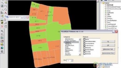
Migrate features from Geographics to Bentley Map
Some time ago we have been talking about what it means to make the leap from Microstation Geographics to Bentley Map, we have talked about how both schemes work and some important advantages of Bentley Map. In a post I already talked about how it is possible…
Read More » -
Geospatial - GIS

Bentley Geospatial Administrator, toothache
The Bentley Geospatial Administrator is one of the things that Bentley has not been able to make digestible and there have not been many exercises that explain its implementation in a real project. The objective of this tool, which is a…
Read More » -
Microstation-Bentley

Bentley Map XM vrs. Geographics V8
In a previous post I mentioned a first impression of what Bentley Map is, now I would like to analyze the similarities so that users who knew Geographics lose their fear of it. If I were Bentley Systems, I would look to bundle applications…
Read More »