Bentley Geopak, first impression
 Similar (not so much) to what AutoDesk Civil 3D offers, Geopak is a series of applications from Bentley for Civil Engineering with which you do work for surveying, digital terrain models, road design and some geotechnics. Although the latter we already know that it will be catapulted after the acquisition of gINT Software.
Run Geopak
 Once installed, a particular icon is not created for Geopak, when running Microstation it is automatically activated. If it does not happen, it is done in Applications> Bentley Civil> Activate Bentley Civil
That includes Geopak.
At the generic level, as Bentley Civil includes several functionalities, Power Civil is a variant with fewer tools and some adaptations to the Hispanic environment such as Power Civil for Spain.
 The functionalities of Bentley Civil are:
- Drainage
- Landscape
- Road
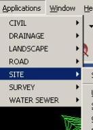
- Site
- Survey
- Water sewer
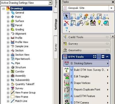
Although the sancocho tool has been improved with the Task navigation where they are listed at the task level as follows:
- Cadd Tools
- Survey
- Geomtry
- DTM Tools
- Site
- Drainage
- Water Sewer
- Plans Preps & Quantities
- Landscape
- Geotechnical
This is a better way to operate, although some are repeated, it is easier to use them because they are grouped based on common uses such as:
Survey: It includes the tasks to import data from topography / gps equipment, edit it, make differential corrections, export to other formats, send it back to the field, etc.
Website: It includes the handling of volumes, preparation of platforms, cuts, design of roads and urbanizations, etc.
DTM Tools: This remains at a generic level to build digital models, contour lines, profiles, etc. Although the necessary tools for Site and Survey are shared there, such as the creation of slope maps, functions to import or export, etc.
Preliminary Conclusion
In terms of functionality, the world is very different from Civil3D, which seems more practical to me since it is divided between objects and configurations, while Geopak stays at the level of tasks, projects and templates. Like Microstation with AutoCAD, Bentley Civil takes a few days to reset the mortals logic, but it has remained consistent, when comparing Bentley Site V8i with SiteWorks 95.
Regarding equipment performance: my respects. The process of the 230,000 lines of the IGN dwg that you sent me Guatemala's friend the other day in Civil3D he made the machine crash after four minutes, dropping a blasphemous out of memory message. In Geopack he stayed for 42 minutes, turning the plate and indicating how many objects he had, but finally he entered them as breaklines in a gsf and converted it to TIN in 2 minutes. The CPU got up to 49% and meanwhile, the PC memory was regular to keep doing other business.
We'll see how to do the same routines that we saw before with Civil 3D.