
... to sell the capacities of What does Free software is more difficult than convincing an official to commit a criminal offense (piracy) By What does not Expensive software.
 Recently Bentley has launched a campaign to promote Bentley Map, using as an argument that it is not necessary to be thinking separately if both can be handled by a single tool. On this, several comment that we are very close to reducing the gap and stop using the words CAD / GIS separately.
There are different points of view, some by economic aspects, others by specialty, others by stubbornness, but in practice with so much technological advance, we continue to struggle with the same problem.
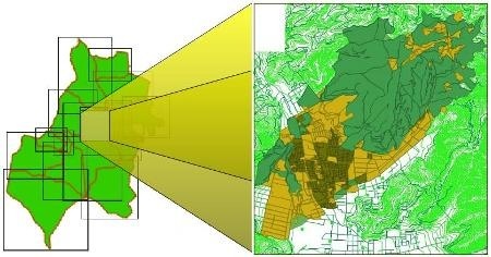
1. The practical case. It happens that to implement a cadastre (To use an example), the vector construction of lines that are stretched, cut, rotated, dragged, images are loaded, etc. they continue to be done in AutoCAD or Microstation. If we ask the technicians why they prefer it they will say:
ArcGIS is not practical for that
GvSIG has tools but runs very slow (on Windows)
Manifold is very unknown and does not have enough tools
Line editing is easier than polygon editing
Support for IntelliCAD is not the same
Then we must do all the construction of spaghetti, in the respective levels, colors, thicknesses, and then pass it to ArcGIS and there build the polygons. When we do this we find Topological errors (That does not recognize CAD), we make modifications and we return to make the changes in the vector, with a cycle that in massive processes ends one day. But in the daily routine of constant updating, changing the CAD and GIS is a can that eventually turns into inconsistent data.
Then, if we want to do something further, we put it into a spatial database (I insist, by way of example), the CAD coordinates, which we see in three decimal places but which have a precision of more than 10 decimal places, now have only three, which forces the vector to no longer be exactly the same, as long as it does not affect the speed of processes in the database. Here the update without topological criteria is much more complex.
And as for the economic, a small municipality should invest in A software To construct precise vectors and Another for make nice maps. If the municipality is tight-fisted or (believes that) does not require an engineering program to use at least one AutoCAD Lite and one ArcGIS plus two extensions; however cheap it is, they are more than $ 4,000 (Without training). Those who have worked with municipalities will know how much it costs to sell this amount to a treasurer who commands more than the mayor.
I know, there are municipalities that do not have these barriers, but the generality of the Hispanic context ... lives that reality for reasons of wanting to do GIS and CAD without smoking astral.
2. The GIS should have CAD capabilities
I understand that when there was ArcView 3x it was not possible to implement vector building tools with topology management, but at this point, I do not understand why we do not have tools in the GIS that only do what the CAD does (30 stuff)
- 12 buttons to create (lines, arcs, circles, polylines, points ...)
- 12 buttons to edit (parallel, copy, move, rotate, extend ...)
- A handy snap control (sorry for my insistence as well as in the CAD)
Sure they already have these things, but we complain about the procedure. They should be similar to how popularized programs are made, with ease of handling directions, distances, coordinates, extension, dragging, clipping ... nothing astral, just like AutoCAD or Microstation do. In this regard, the best we have seen has been the effort of gvSIG, which instead of reinventing the way of making vectors, adapted to the way of Do it with AutoCAD, With millions of users in the world doing so (Aware that AutoCAD has archaic procedures). There is work to mature in working speed when loading heavy images or large files; I'm sure it runs better on Linux, but not on Windows, and a Strong challenge For convincing the world that the open is not to belittle.
3. There is CAD that already does GIS
In the case of Bentley Map and AutoCAD Map, the position has been to create GIS capabilities for the tools that were used for engineering. The progress has been significant, there is no doubt about it, but to date many display and publishing functionalities (painted maps) are weak at what the GIS does well (or better). I also think that the practicality of implementation for simple jobs remains ... Hair pull; if not, let's see how many AutoCAD users (millions) and how many (who would like) AutoCAD Map (or Civil 3D); not for price reasons, as the comparison could be the same if we do it with users who use the licenses pirated. It behaves almost the same with Microstation and Bentley Map, without getting into publication and interoperability aspects (please).
4. CAD and GIS are two different topics.
There is a (grounded) position that says that both topics are two specialized areas and that there will be no capacity to do both with the same tool; Part of that posture inherits our perception of a few years ago:
... CAD is for making accurate vectors and GIS for beautiful maps.
But this specialty stance, as standards have matured and been appropriated by non-free software, has lost rigidity, initiatives such as OGC on the GIS side, implementation of the concept Topology, use of the xml that advances to the BIM concept on the side of the CAD, among others, that have made the CAD not be seen as the drawing board but part of the work of real specialties (Architecture, Civil Engineering, Topography, etc).
The trend says that the specialty will not be in the software (CAD / GIS) but in the application area. To give an example, designing roads should be the specialty of a software that does that, with the precision of CAD and capabilities to serve it towards programs that will use the axis to make cartography under a GIS context. Likewise, the shapefile should go down in history and the GIS data should be a graphical or tabular representation of reality whose geometry can be edited from the GIS side, querying its attributes, knowing its connections to other data; while from the GIS side its wonderful representations, linking to data and being able to edit with the precision that CAD would.
But for that ... we are honestly far away, not because there is not Already formed, Small tools already do a lot of that, but you have to move the big brands of software to implement it in a practical way.
4. As I see it
I think for a while, we will continue to use two programs to represent the same property: editing its vector in CAD, analyzing it in GIS, and modifying it in both. In my opinion, many things we do have loaded so much smoke that it lost the simplicity of its use for practical purposes and technological marketing (a problem) has made us forget the reason for human inventiveness (to solve problems).
 The drawing table had its glory, because no one invented another way to make drawings by hand, electric erasers were added to more but the systematization of their practice was not in the material of the table but in what we did there. Cartography was making maps under systematized standards of scale and relevance, we thought about what to print it but we never doubted its use for human purposes.
We should not lose consciousness, because now technology should make things easier for us and enhance ITS USE. So, there should come a time when the investment stops being about formats, processors, pixels, labels and brands, to invest time in the reason for which they were created: THEIR USE. As a result, as before, dedicate ourselves to generating business, wealth and benefits for people.
But the idea is illusory, and in my opinion, the next 5 years, for the majority of projects of the level raised at the beginning, we will continue doing things the same (see, let's not end it doing it in Google Earth). And the CAD / GIS software producers:
- On the ESRI side, maybe Let's see improvements In the ability of CAD construction, hopefully not have to re-learn to use the drawing table again.
- On the AutoDesk side, popularize Civil 3D to see Mapping as part of engineering. Idea that seems right to me.
- On the Bentley side, promote PowerMap For low-priced CAD to have GIS capabilities, and perhaps to facilitate implementation smoothing.
- On the low-priced software side: Manifold, Tatuk GIS, Global Mapper, IntelliCAD, gaining ground by doing what brand name software doesn't.
If the Open Source software (sustainable) crosses this barrier, surely we will all look back there, not only by the economic aspect (Which we have already seen), but by solving common problems (which it is already doing) and a more aggressive global marketing than piracy.
Pessimistic, perhaps; delusional, sure. And you: How do you see it?


hi Cesar
What happens is that the coordinates of your survey, being UTM, are the same as those that could be in 60 possible UTM zones of the world, so you have to define which one you are in. Also, the Datum is the reference ellipsoid, to give you an idea, as if the WGS84 were at sea level and another Datum such as NAD 24 passed 3,000 meters above, the property could be the same and at one point the latitude and length are the same, but the projected distances on these two different spheroids are not the same. That is why the UTM system is often called "projected".
To do it in ArcGIS, right-click on the layer you are interested in georeferencing and choose the "properties" option, then in the panel that appears, choose the "source" tab.
There, there is a button to choose the “source”, then you enter and there you go to look for a projected system (UTM), then you choose the corresponding zone and if you are in the northern or southern hemisphere.
With this your file is georeferenced to the datum and respective zone.
A greeting.
Good morning, I congratulate him for the excellent blog that he handles, I tego a doubt I have converted a dxf file to shp my file in cad this georeferenced and in fact in the gis, that by some use arcgis 9.3, I appear the coordinates but as unidentified , I know that I should put the information of the datum and I know what it is, but I do not know how, I would like to know this since I searched everywhere on the web but I do not find a real answer, I would appreciate it very much, if you could answer my question, please be cordenadas utm With gsw84
“””jose maria said: March 16, 2010 – 8:36 pm
how to pass a drawing in cad to arc gis or to arc view”””
Resp: from autocad map you export shapes lines, polygons (creating topologies) and points.
To solve the problems of topological errors in cad there are many erramients such as the drawing clenup of autocad map help to debug the cad files before export or their use as layers related to objectsdata or in shapes. Also in arcgis as in other software gis as the openjump there are topological validators in my case I use both taking into account that in arcgis is important the resolution xy (tolerance) and q that depends on the quality of the layer, with openjump we can look for polygons With holes or vertices at a minimum distance required smaller angles.
regards
From ArcGIS you load it as a layer, then you make it into Featureclass
How to pass a drawing in arc to gis or arc view
Hello
I see that you speak from the expertise of a "CADISTA".
First things already known: Both software have different orinetaciones.El know when using one or the other is things of the user. We do not intend to use a flat of a house (CAD) in a GIS that for me is a software of ANALYSIS more than one that made nice maps (for that this mapublisher or corel etc).
The implementation of the topology concept on the side of GIS in the years of arcinfo seemed a good solution for the solution of topological errors. From the mythical Arc / Info, esri has those buttons that you talk about:
-buttons that are used to create (lines, arcs, circles, polylines, points ...) Unless you talk about things you dislike:
-buttons to edit (parallel, copy, move, rotate, extend ...) Those same ones have them unless you refer to something else.
-A practical snap control…. “Let the lines that are at a distance of 10 m come together….” That? “that they intersect where they intersect”…That? “let an arc extend to intersect another”… That? How in CAD then?
On the other hand, the desires for software integration go hand in hand with the activity of the users, for example I cry out for a greater integration between ARCGIS Splus or Matlab for example ...
I believe that for the construction of a GIS project, the flowchart for my seria: construction of vectorial base in CAD, alphanumerical database in ARCGIS, construction and analysis of images in ERDAS (that on the contrary I think that a CAD images are only of Background support and no data with information with is in the GIS) and modeling in ARCGIS.
Since ARCGIS (from ARC / Info, UNIX at least) handles double presicion in the coordinates of the vectors, there would be no problem of loss of precision. So ONLY it is missing that CAD can solve TOPOLOGICAL errors and the union of GIS / CAD would be a honeymoon.
However, all that is in terms of software since in liveware, CADISTS will have to learn to handle their projects more ORDERLY (the rivers in one layer and the streets in another) I hate receiving CAD information with polygons that are not such, lines without topological continuity (only graphic), and arches that represent rivers in layers that represent streets….