ArcGIS course applied to Mineral Exploration
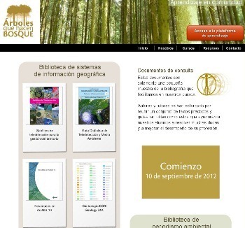
 Trees that make forest is a company with an interesting offer of training in the geospatial area, is composed of specialists in different disciplines, accredited professionals capable of transmitting knowledge in a pedagogical way and who wish to share useful experiences with their colleagues by profession.
This time Trees that make forest is calling for a new stage of the ArcGIS Online Course applied to mineral exploration. This is an interesting course where apart from learning to use a GIS tool, it is oriented with priority to the management of geological data. It is planned on two levels:
Level 1. I start the 10 of September of 2012.
The duration is 8 weeks, with a total of 50 hours.
This course is aimed at all professionals who wish to manage their information in a GIS in the ArcGIS environment. Throughout the seven sessions that make up the course, you will learn to visualize and process the data and to navigate with ease within the application.
The course is essentially practical. The proposed exercises handle geological information, of special interest to professionals working on both mineral exploration and production mines, but can be applied to any other field of activity.
1 Level Program
- 1 Session: Introduction to GIS. Cases of use of GIS in mineral exploration. Tips for storing and naming files.
- 2 session: The ArcGIS environment: ArcMap, ArcCatalog and ArcToolbox.
- 3 Session: Application of symbologies to points, lines and polygons.
- 4 session: Georeferencing of scanned maps.
- 5 Session: Coordinate Systems. Essential concepts and some tricks to avoid mistakes.
- 6 Session: Editing Polygons and Tables. Carrying out a layer of lithological units from scratch.
- 7 session: Composition of layout Of a map for plotter or home printer printing.
- Conducting a practical test.
Level 2. 12 starts 2012 in November.
The duration is 10 weeks, with a total of 70 hours.
This course is designed for those professionals who work in mineral exploration as well as mining in production: geologists, geochemists, geophysicists, mine engineers, cartographers, geographers, geographers, geographers, geologist assistants or any other professional working with geological information. It will help them to manage the information in a simple, fast, efficient and precise way, avoiding typical errors that occur in the different steps involved in the transformation of this data into the knowledge required to make decisions.
You must have basic knowledge of ArcGIS or have completed the 1 Level course.
2 Level Program
- 1 session: Combining and displaying a lithology layer with a grid Of geophysics.
- 2 session: Working with satellite images.
- 3 session: Georeferencing of raster files.
- Session 4: Working with geochemistry of surface samples.
- 5 Session: Introduction to relational databases. I work with related tables.
- Session 6: Symbology suitable for layers of lithology and geochemistry.
- 7 Session: Geoprocessing and Formatting Tools Geodatabase.
- 8 Session: Digital elevation models (DEM) and everything that can be obtained from them with geoprocessing (extension 3D Analyst).
- 9 session: 3D display, introduction to ArcScene, 2D vector conversion to 3D (3D Analyst extension).
- Conducting a practical test.
Teacher of the courses: Marta Benito, expert in management of geographic information systems. After holding the position of GIS Manager in some of the leading mining companies in the world, she is currently a principal partner and consultant in the company Natural Resources GIS.
More information: http://www.arbolesquehacenbosque.com/curso_sig.htm
Also in the mail Info@arbolesquehacenbosque.com More information can be requested regarding prices, modality and type of accreditation.
Additionally we recommend to see other resources in this web, as the case of the library, where there are links for downloading documents that will surely be useful.
http://www.arbolesquehacenbosque.com/biblioteca.htm


When a new online course starts
Good time! Greetings from Colombia, this course: "ArcGIS Course applied to Mineral Exploration" has been taught again? If so, when will it be taught again?
Good time! Greetings from Colombia, this course: "ArcGIS Course applied to Mineral Exploration" has been taught again? If so, when will it be taught again?
I request a formal invitation to present to the company where I work, and formalize the permission and authorization for the attendance to the course.