
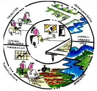
The georeferencing of rural properties
This is the name of the event, which can be viewed face-to-face or distance the next 7 of November of 2012.

We take this opportunity to promote this initiative, which is promoted by MundoGEO, on the georeferencing and certification of rural properties. Participants will be able to update their knowledge of the legislation knowing practical cases and discussing the best ways to approve projects.
This event will address the current issues of Brazilian legislation and the technical standards necessary to approve projects in the INCRA and in the Property Registries. The specialists related to Incra, the Registries, the professionals and companies that carry out this type of work, will discuss practical cases in the area.
The event will be held at the Bourbon Convention Ibirapuera Hotel, in São Paulo, Brazil, on November 7 from 9: 00 hrs to 17: 00 hrs. Those interested can register to participate in person or online, since the entire event will be transmitted over the internet and you will be able to interact in both cases. To follow the online seminar, registration must be made up to one day before the event. For face-to-face participants, registration must be done in advance, or on the same day.
Those attending the face-to-face seminar will be able to know the services and equipment of topographic automation and the software used in the georeferencing of rural properties.
For more information visit the page.
Check the agenda and register early! Limited space!
Agenda
From 7: 30hrs to 9: 00hrs: Accreditation
From 9: 00hrs to 9: 40hrs: News on online services for Certification of real estate
From 9: 40hrs to 10: 40hrs: Integration between INCRA, Registries and Treasury
From 10: 40hrs to 11: 00hrs: Coffee break
From 11: 00hrs to 12: 00hrs: New techniques for field surveys
From 12: 00hrs to 14: 00hrs: Interval
From 14: 00hrs to 14: 40hrs Case studies of field surveys and generation of technical parts
From 14: 40hrs to 15: 40hrs: Errors most common in the presentation of technical parts and how to avoid them
From 15: 40hrs to 16: 00hrs: Coffee break
From 16: 00hrs to 17: 00hrs: Debate on the technical, legal and operational challenges for the approval of the projects of Georeferencing of Rural Properties
Register at: http://mundogeo.com/seminarios/gir/inscricao.html
Service
Seminar: The georeferencing of rural properties (Online and Online)
Date: November 7 from 9: 00hrs at 17: 00hrs
Local: Hotel Bourbon Convention Ibirapuera - Av. Ibirapuera, 2927 Moema - San Pablo Brazil.
Contacts: Seminario@mundogeo.com / (41) 3338 7789 / (11) 4063 8848


In Peru, the georeferencing of rural properties has been used, there is a registry of Rural Properties in the OfinanRegsitral of each department of Peru, this work was started by the Special Land Titling Project, to give legal security to those properties still not cleaned up both legally and physically, now farmers can mortgage their properties or associate to lease their properties duly registered and with their Cadastral Unit, which is what identifies each property and each owner according to the UTM coordinates in PSAD 56 as to the digitized cadastre through aerial photographs that are restored to plans.