
GvSIG 2, first impressions
In the course we have decided to try the new version of GvSIG, which although it is not yet declared stable, it is possible to download different builds to see which wave.
I downloaded the 1214, and although I expected to test the symbology features of points and lines such as he had told me xurxoApparently I will have to try the 1218. Here are the first impressions:
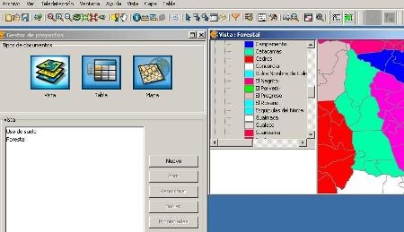
1. Face
Definitely, it was time to improve the iconography that was somewhat caveman.
2. Toolbars
Now it is possible to show or hide toolbars, which seems that instead of being loose extensions they also have a grouping category. These can be seen as options at the time of installation.
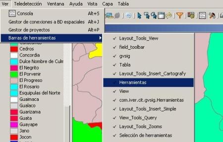
 Some actions have also been grouped in the top menu where they can be applied to specific layers.
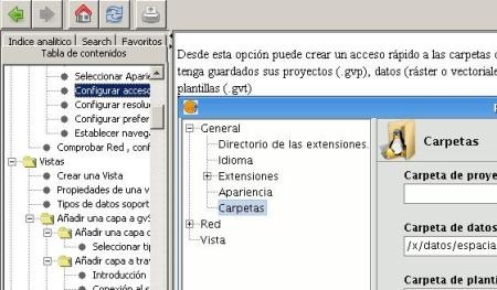
4. Aid
(Help) Although it does not appear to be a chm, the help has that appearance and can be accessed without having to navigate through the pdf manual
3. The extras
(KML) Now when loading a layer, in addition to the gml, shp, dwg, dgn and raster the alternative of loading a kml has been added, although I do not see that it is possible to export to this format.
(Construction) Some new construction commands have been added, such as spline and array. Also now it is possible to see the commands whose extension is not active such as explode, join, break, stretch and those that in the previous version unless you went to the extensions and activated them ... you would not know they exist.
(Remote sensing) In addition to improvements in the functionality of the raster layer, several functionalities have been created for working with images, including classification, calculation of bands, definition of regions of interest and image profiles.
(Topology) Although this extension is available not only for the 2 version, we have tested and indeed, it is possible to convert an archaic shape into a topology with precision, rules and minimum number of accepted errors.
4. When
Only God knows, maybe next week they are saying when they hope to release a stable version.


Because I have not heard many improvements about it, surely the guys from Geomatic blog need to know more
Hello Cartesia forum members, at work, in addition to using Arcgis (we have very few licenses (you can imagine what they are worth), we also use GVsig for minor jobs. My question is if you know what graphic output version 2 has, because the that I use has a rather poor capacity, when it comes to presenting and making the plans "pretty"…?