Show OVC catastro meh data in Google Earth
I recently told them how to do This with Manifold, and thanks to that post I have been able to find out how to do it with Google Earth. To begin with, if you want to see data from the Cadastre, National IDE or Virtual Cadastre Office, these must be published as map services (WMS) following the standards of the Open Geospatial Consortium (OGC)
So that we can not only see data of these institutions, but others of which we know their service address. Let's try in this case with the services published by the Spanish cadastre.

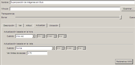
To add IMS services, it is done in “add / image overlay”, then select the “update” label, and the “WMS parameters” button; you can also add transparency via the slider.
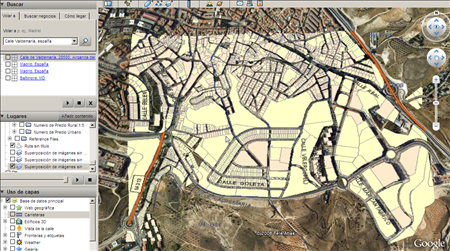
If you want to see the CARTOCIUDAD data, add the url “http://www.cartociudad.es/wms/CARTOCIUDAD/CARTOCIUDAD”, then choose the attributes to display.
The result is this:
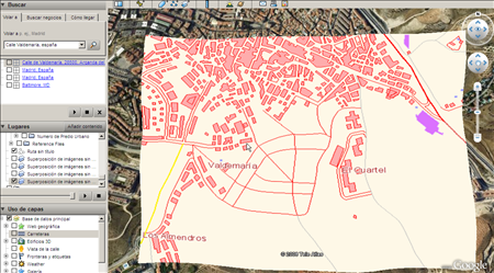
If you want to add the map to the Numerical Cartographic Base 1:25.000 and 1:200.000 of the IGN, select the url "http://www.idee.es/wms/IDEE-Base/IDEE-Base" and this will be the result :
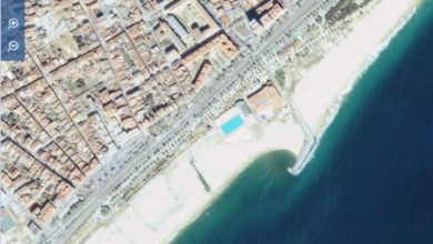
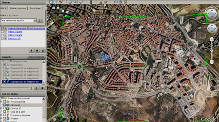
While if you want to add the orthophotos of the National Aerial Orthophotography Plan (PNOA), this is the url “http://www.idee.es/wms/PNOA/PNOA” and this will be the result:
... is to find out what wms services are available for your country, it's supposed to be the Clearinghouse, That are not fallen and suddenly you have a little luck.
If your country does not have implemented ... is lack of confidence, who knows if there ends up doing a consultancy this server 🙂
This is an example of connecting to the orthophoto of Andalusia from "General flight of Spain of the year 1956" using this address:
http://www.juntadeandalucia.es/medioambiente/mapwms/REDIAM_Ortofoto_Andalucia_1956?