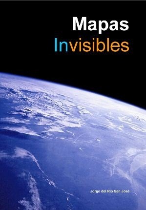
Invisible Maps, my suggestion to read
 Next week the book Invisible Maps will be released. An interesting work by Jorge del Río San José, in which he makes an interesting approach to a subject that, although old (maps), has evolved dramatically in recent years, especially due to its application in the computer field, the Internet and geomarketing .
The book tries to help cartographers and field users understand the relationships between disciplines that have now come to complicate us -And solve- how to plan business and disseminate information. For this, different topics related to maps, the operation of search engines, social networks and Internet advertising are addressed.
It is pleasant to see content based on topics that we are passionate about, and almost with words that we ourselves would have captured. It is more pleasant to know that there are those who invest their time in systematizing information in a document that today is fortunate to be disposable after the hashtag takes a backseat. This book, apart from opening the panorama to a topic that is daily for us, guarantees a space for reflection related to this context: it allows us to learn more, associate topics about which we had ideas and, above all, preserve in a bubble a moment that no longer it will be the same in two years -or less-. It is the gain of the person who systematizes, who takes the merit of describing a moment for others every day; I would like to be able to compare it with a similar document drawn up in the sixties, when maps, as they did not have an associated database, became true artistic works, limited to a printed rectangle but that they surely enjoyed with the intensity that we now live this moment.
In short, a good effort, the concept INVISIBLE MAPS Part of two paradoxes:
The first is the large capacity of production of cartographic contents that we attend today thanks to technologies such as GIS, GPS systems and remote sensors. It is a completely new phenomenon. We can design maps with great ease, and at a much lower unit cost than at any other time in history. The reuse of data and design technology allow us.
The consequence is that many of them are not very different from others: it is a production environment for cloned maps, of serial products.
The second paradox is a consequence of the Internet. The audience has increased, but the creation of content much more, which is why attention is the new bargaining chip, a scarce good, for which our maps, like the rest of images, enter into stiff competition. Maps are no longer a single content to hybridize, enter into symbiosis and most of the time in tough competition with all kinds of images: from photographs to infographics. The map has been socialized on the Internet and has become one more image.
The solution to the anonymity of the map goes through the creation and implementation of Internet dissemination plans.
I leave the index to increase your interest.
THE PARADOX OF INVISIBLE MAPS
1. The invisible maps yesterday and today
2. The map image new role of the map on the internet
 THE MAP, IMAGE ON THE INTERNET
3. Are maps interesting?
4. The value of the map: Power for users
5. The map has died the map alive
6. Maps service and maps product
7. Internet, the new basilica of maps
8. Statistics of the use of images of maps in Internet
THE MAP, CONTENT ON THE INTERNET
9. The marketing plan
10. Map Design
11. Designing for the Internet
12. Carrying out the map
13. The tags
14. The dissemination plan
SEO AND MAPS Search Engine Optimization.
15. The visibility of a map
16. Visibility of the map and traffic
17. Map web traffic
18. Typology of readers of an Internet map
19. From the basilica to the map forum
20. Production of maps: size of cartographic agora
21. Why publish a map as an image?
22. Google images and maps
23. Notions of SEO optimization with maps
SMO AND MAPS. Optimization for social networks
24. Dissemination of maps in social networks
25. Maps on Twitter
26. Maps on social networks
27. Maps in image catalogs
28. Maps on Wikipedia
29. Licenses to use the maps
30 Follow cartographic information on the Internet in 4 steps
31. Internet Map Sources
Catalog of good practices in Google images
For now I have been privileged to see it at first, but if you want to be aware of where you can find printed or where you can download the digital version, I recommend following the author:
Twitter on the account @orbemapa
En Orbemapa.com which is the step that has now been reached with Wordpress, which we used to know as Mundomapa in Blogger. Here you can see the most read in Orbemapa.


