Integral Migration to Free Software
 It has been published under a Creative Commons license, in Spanish and English version, a systematization of the experience of the Ministry of Infrastructure and Transport of Valencia in its migration of commercial software to free software.
The project was called gvPONTIS, and more than having the reconstruction of the experience, has a great work of methodological review and a high level of final editing.
 I would like to talk a lot about this document, but my best recommendation is that you download it and send it to print in color because it is on the fence. Ideal for a Hispanic country that intends to follow that same route; interesting that much of this project was achieved with the same silver that was used to exist under commercial licenses.
For us this fact is important, since gvSIG was born from this project, a tool that differs from the others under a free license, for being part of a long-term project that involved not only the subject of cartography but "all" the others computer systems in use.
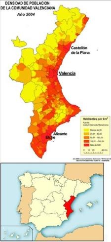
Now gvSIG has been internationalized and many of us have presaged that it will be free software for GIS use that will become more popular in Europe and Latin America (if they do not lower their guard in his promises). The map shows the Valencian Community, which already exceeds 5 million inhabitants, in more than 540 municipalities, about 10% of the total population of Spain.
The document is divided into three parts, and this is the index:
Part 1: Corporate and Web Developments
- Chapter 1 An overview
- Chapter 2 gvDADES: experiences with Database Management Systems
- Chapter 3 gvMÉTRICA and MOSKitt: definition of a development methodology and its support
- Chapter 4 gvHIDRA: developing a framework for PHP
- Chapter 5 Implementation of Version Control Systems: CVS and Subversion
- Chapter 6 Implementing a Reporting Tool
- Chapter 7 Migration of the web portal and Intranet
- Chapter 8 Worklow for processing and monitoring of files
- Chapter 9 gvADOC: document management system
Part 2: Operating Systems and Communications
- Chapter 10 Initial User PC Environment
- Chapter 11 Local Network Server Environment
- Chapter 12 Communications and networking environment
- Chapter 13 Corporate Servers
Part 3: GIS and CAD
- Chapter 14 gvSIG: introduction
- Chapter 15 gvSIG: description and justification of the initial situation
- Chapter 16 gvSIG: evolution to the current solution
- Chapter 17 gvSIG: conclusions
- Chapter 18 gvSIG: next lines of action
The document is not conclusive in the sense of stating that it has already been completed, rather it is a memory that reflects the initial state, how it was addressed, conclusions or recommendations and steps to follow. In the case of gvSIG, something is extracted from what was published in the 4tas. journeys, but it has been added texts such as the principles of the INSPIRE initiative, which are seeking to be a point of reference for the countries of the European Union.
Here you can download the document.