
The UTM coordinates in the southern hemisphere
In response to a request made by Anahí from Bolivia I have created a file that contains the UTM zones of South America, which can be very useful for educational purposes, although I recommend reading the post “understanding the UTM coordinates".

By opening the file using Google Earth, the implication of the UtM zones can be easily explained in a class.
To see the UTM zones, it is done in “Tools / options / 3D view” then in the “show lat / long” field, choose “Universal Traverse Mercator”
To show the grid, do “view / grid” or CTRL + L
 So we can see that the southern cone countries are in these UTM zones:
- Peru: 17,18,19
- Bolivia: 19,20,21
- Argentina: 18,19.20,21,22
- C
- Paraguay: 20,21
- Uruguay: 21,22
- Brazil: from 18 to 25
- The case of Ecuador remains in the 17 and 18 zones, but with segments in the northern and southern hemispheres.
- Colombia is between the zones 17, 18 and 19 and also has in the two hemispheres
- Venezuela is only in the Northern Hemisphere, between the 18, 19, 20 and 21 zones
- and Guyanas and Suriname are between the 20, 21 and 22 zones
This last image shows Bolivia, which is between the 19,20 and 21 zones; the point marked in red is a clear example of a coordinate that is in the 19 zone, in Lake Poopó and that has the same length and latitude in zone 20 in the plain of the Great Chaco.

Here you can download the kmz file, which you can open with Google Earth:
If you are interested in having all the zones, in the following link you can purchase a file that contains all the UTM zones. Includes the zones:

you can acquire it with credit card or Paypal


Cordial greeting appreciated Ing.
Thank you, your concepts are very valuable.
bkn
Thank you
How do I write the 699051.00 10116907.00 coordinates located in a sector of the canton Rioverde, province of Esmeraldas, Ecuador
Hello I see very interesting, the subject of Global Mapper, I would like to know how I determine in which area is located an area of interest located in Colombia. Thank you
We are working in the Paraguayan Chaco between grades 60 and 62 degrees of Longitude and 22 degrees of latutud. very close to the zone change between the 21 and the 20, but within the 20. We have made a coordinate assignment bell through satellite GPS of points distanced between approximately 3.000 meters. In parallel to that thereon endpoints have made polygonal round (closed) with total station, we set ourselves tolerance 1 / 25.000 in planimetry and have managed to close said polygonal within tolerance. Taking as a base one of the extreme points and assigning to them the coordinates of GPS and calculating the coordinates of the next extreme point with the data of angles and distance of our polygon made with total station and my reliable as mentioned above, we are not finding differences close to one meter between the coordinates calculated and those obtained by the GPS, this difference I consider to be very large. If someone could tell me how to solve this problem.
regards
Very good page
Perhaps the best place to find information with that breadth is the Forum of Cartesia, in the Property and Cadastre section where much has been written about it.
http://www.cartesia.org/foro/viewtopic.php?t=20492
VERY INTERESTING YOUR APPRECIATION, THANK YOU FOR YOUR COLLABORATION. BUT I WOULD LIKE TO THINK A LITTLE BIT IN THE QUESTION, AS THE PRECEDES RECORDED BEFORE THE YEAR 70 WAS ONLY WITH A CROQUIS AFTER WERE PLANNED WITH PERIMETRIC MEDIATES NOW NOW THE PLANES WORK WITH UTM COORDINATES, THEN THE PRESENTATION OF MY PREDIO THAT FOR REASONS X NOT JOINTLY INSCRIBED WITH THE NEIGHBORS IN THAT TIME IT HAPPENS THAT THE REVISION BY CATASTRO INDICATE TO ME THAT IS DISPLACED OR OVERLAPPED ON THE PREFERRED HOLIDAYS THE SAME THAT WAS PREVIOUSLY ENROLLED THAT REVISED THE LEGAJO FIND A PLAN WITHOUT COORDINATE THE SAME AS NOT CONFORM TO THE CURRENT COORDINATE WHY MIGHT HAVE THE AREA ITSELF AND pERIMETER MEASURES BUT THAT IS DISPLACED IS THIS PLANE AND NOT MINE BECAUSE IT HAS GREATER ACCURACY, conversed WITH presonal AREA CATASTRO ME INDICATE THAT TO SOLVE THIS PROBLEM WOULD HAVE TO UPDATE THE CATASTRO IN PUBLIC RECORDS OF ALL THE PREMISES REGISTERED WITH ANTERIORID AD cadastre NEW, NOW I NEED TO KNOW WELL HOW TO SOLVE IS IN OTHER COUNTRIES AND THE TRUTH I would be grateful INFINITELY Submit AREA CONCEPTS overlay, GRAPHIC OFFSET, why not find much theory on this topic. YOU ALREADY KNOW HOW MUCH INFORMATION IS NEEDED TO DEVELOP A THESIS. THANK YOU AND GOD BLESS ME.
In any case that the registration of a new property affects geometrically to one already registered, it does not matter if it was measured with less or greater precision, it requires a modification in which it must be quoted to both owners.
Surely the registration procedure will indicate that a reification of both is a rectification of measures as the reality will reflect that there was a problem of measurement for using different methods of removal or a conflict of tenure between the two.
Thank you for this interesting information.
I am doing my thesis on overlap of area that affects the inscription of properties in SUNARP Arequipa. 2010-2011
It is the case now plans work in UTM coordinates and COFOPRI entity responsible for issuing land registry certificates for registration in public records and when the rate cadastre Public Records Arequipa tell me that is overlapped partially with an estate adjoining, and yy notify me with observation which is that the documentation submitted is superimposed cparcialmente with adjoining land that was already inscribed with a fiscal cadastre the same was not drafted in UTM coordinates, the question is how is solved this problem without making rectification of area because I am not the owner of the other property subject of superposition, would have to do the update of the already registered cadastre. PLEASE SEND ME THEORETICAL FRAMEWORK CONCEPTUAL SURVEY OF AREA AND THE MOST SUCCESSFUL SOLUTION TO THE RESEARCH PROBLEM. THANK YOU
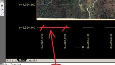
And what program do you use? almost any GIS program can help you place the coordinates at the edges of the layout.
If your lift is in two zones, you must indicate the limit.
If you want to convert the coordinates, you can use this template with which you can make geographic conversions to UTM for your work.
http://geofumadas.com/convierte-de-geograficas-a-utm-en-excel/
I am new to this area issue as it is a surprise, so much so that I did not even know that such zones existed.
I would also like to know if there is a program or formula to change from zone 17 to zone 18 ...
The job asks me as a pre-professional presentation for the MEN.
Thank you friends for your response in advance.
It's funny you know a lot of information with you ..
But I need help friends ... I want you to know how I can present my field survey plan that is precisely between Zone 17 and 18 ... since I have it present indicating the zones and that at the same time I will have to place the coordinates on the side of the drawing ...
Greetings Cross
I congratulate you for your apollo to everyone in this branch of geodesy that is very interesting today thanks
humbrto obando from lima - peru
Dear I want to know how to convert from flat or topographical coordinates to utm in 18 zone peru
The link that appears at the end of this post, allows you to download all areas of the southern hemisphere in kml format, you can convert them to shp with any GIS program such as ArcGIS or gvSIG.
what I am looking for is the limit of these areas especially for Peru…. I want the limit of these areas (17,18, 19 and XNUMX) in shapefile format .... Thanks in advance to anyone who can help me
Congratulations on keeping this space devoted to this type of issues,
I have been very useful your contributions.
Excuse me for wanting to "take advantage" of their knowledge, but I need to convert AutoCAD files .dwg to KML type, to be able to visualize them in GOOGLE EARTH
Greetings titobam
when a topographic survey is taking place eg: venezuela guarico state and in the path we start with zone 19 and in the path changes to zone 20 when drawing there is a displacement in the coordinates of more or less of 500.000 to 600.000 mts of difference. The question is how do I compensate for this demapment so that when drawing by coordinates the points do not differ or the formula to apply that correction so that the plane is consistent points?
_______20___
19
ex: COORDINATES N-1041699.00 - E-170555.00 ZONE 20
COORDINATES N-1041706.00 - E-829452.00 ZONE 19
Venezuela, between the 18, 19, 20 and 21 zones
I need to know what the utm zones of Venezuela are.
Hi Katya, I do not understand what your question is.
parameters of the 19 south zone?
Hello Jimmy, to place UTM coordinates, I recommend you use Plex.mark , is a very practical and free application.
If you mean to change the visualization, to not see the geographical coordinates or utm, what you have to do is change it in the options
The difference you see is not in the coordinates, but in the images. Splicing errors between images show the imprecise which is the image of Google Earth, so the coordinate is correct but the image is displaced.
Thanks x your rpta, I would like to know how you could place a mark using UTM coordinates, since by default it brings the geographical coordinates,
To be able to georeference it in a GIS program.
Also using some coordinate converters from degrees to UTM differ greatly from what is shown in Google earth, because ?.
Thank you
It's the same
Thanks for answering so fast, but I still have the doubt of whether it is the same as what was obtained in Google Earth. That is, if in Google Earth I read, 18 H 673570 m E // 5921730 m S, I can report without problems as 18 H 673570 m E // 5921730 m N ?, or do I need to do some transformation ?.
Thanks for your time.
That's right, it is handled North and East, but it is understood that it is in the Southern Hemisphere
Hello:
A query, in Chile UTM North and East coordinates are requested to set a point, but if I see in Google Earth, the coordendas appear as S and E. Is it the same or do you have to make a conversion ?.
In advance, thank you very much.
Greetings.
-.gg.-
Tell the teacher to change the assignment.
: )
To all of the group of ing aranibar q came here to take the task d the help you tell them are a few lads lol
Thank you, thank you very much. They do not know how much they have helped me. Thank you
The coordinates are fine, what has errors is the satellite image of more than 30 meters, so it does not match a precise survey with that data.
the coordinates in google earth are displaced, they are not exact
Hi, thanks for the explanation.
you go to google earth, you write mar de huacho, peru
then you enter
Then you move to the place of that area that interests you and read the coordinates below
I need the Long coordinates. and latitude, of the sea of Huacho (PERU)
Thank you, the correction is correct. I've already made the necessary adjustment.
Peru is located in the zones 17, 18 and 19. there is a mistake with what you have posted.
It is a good contribution for all who seek this kind of information thanks.
enter google earth, write that in the search engine, and then identify the area where you think the center is
I would need the Long coordinates. and latitude, of the approximate center of CAMPO CLARO (Tarragona)
What a wonderful thing, super configuration trick ... I've spent hours looking for maps in UTM with good resolution ...