
Holidays sponsored by Google Earth
This week, known as "Holy Week" is a holiday at least Thursday and Holy Friday, I have taken three days of my scheduled trip to Charlotte, so I'll be resting all week thanks to Google Earth.
I explain, literally Google Earth is sponsoring my 8-day vacation. It happens that about 7 months ago an American who sponsors a poor child was interested in knowing these latitudes, tired of looking for the place of origin of his godson, in an interesting coincidence he entered the Google Earth layer called "community", and ended up in a tourist page whose contact form I must take care of in my spare time. Finally after a good online friendship, he decided to come here to spend 8 days on the condition that he was his pilot, took my family and if there was time I would help him find the family of his godson.
So here I am, doing internal tourism, promoting the external and incidentally finding sponsorship for a long time to a boy who has great aspirations but few economic resources. The task does not end there, we still have to find the boy's family and I hope tomorrow to be a detective, for which my Digital model Of land.
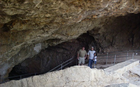
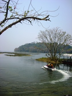 My boys are happy with their gifts: new binoculars, the new Benq camera, their fishing rods and the desire to test if the gringo lures work with the "tilapia" of the Yojoa lake. So far, 5 hours of travel has been very profitable, we have visited some very interesting caves along the way.
The mosquitoes are criminals because of the heat but the coconut water is ... to suck your fingers.
Oh, be patient, the wireless in this hotel is a calamity but;
As a great philosopher Austrian:
" I will be back "


