#GeospatialByDefault movement gaining momentum; Join GWF 2019 in Amsterdam
Geospatial World Forum XNUMX is set to be the most talked about geospatial event of the year with XNUMX+ delegates, XNUMX+ CEOs and senior government officials from XNUMX+ countries in attendance.
The most premium global event for the geospatial community, with the theme #GeospatialByDefault: Empowering Billions, opens in five days. The event is scheduled to take place at Taets Art & Event Park, Amsterdam from April XNUMX to XNUMX, XNUMX.
200+ CEOs and senior government officials in attendance
CEOs of top brands in the industry, including Hexagon, Esri, and Trimble, will address the audience at the conference, to give insights on the evolving technology trends, new business models and share how geospatial is becoming an integral part of all businesses, government and our daily lives.

Prominent CEOs/business leaders include:
- Jack Dangermond, President, Esri
- Ola Rollen, President & CEO, Hexagon
- Steve Berglund, President & CEO,Trimble
- Jeff Glueck, CEO, FourSquare
- Javier de la Torre, founder and CSO, CARTO.
- Massimo Comparini, CEO, e-Geos
- Brian O'Toole, CEO, Blacksky
- Frank Pauli, CEO of CycloMedia
Further, heads of several national geospatial agencies, C-level executives from major user organizations, and top-ranked officials from multilateral agencies such as United Nations and The World Bank have also confirmed their presence.
User-focused programs covering entire gamut of global development agenda
Symposiums on Smart Cities, Construction & Engineering, Sustainable Development Goals, Environment, and Location Analytics & Business Intelligence, featuring over 60% end-user speakers, are set to be the platform for dialogue exchange and sharing of best practices across geographies.
High-profile speakers include:
- Deputy Mayor of Brussels
- Chief Programs Officer of Cadasta Foundation
- Chief Digital Officer from City of Athens
- Sustainability Director from City of Sydney
- Head of Sustainable Initiatives Office at European Space Agency
- Manager, Global Forestry and Pollution Enforcement at INTERPOL
- Head Geospatial Solutions at Munich Re
- Founder & CEO of Radiant Earth Foundation
- Global Director – Digital Engineering and Automation at Royal HaskoningDHV
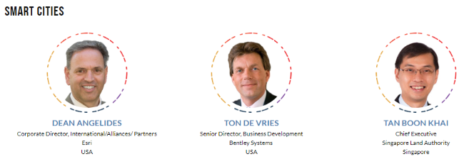
- Chief Executive of Singapore Land Authority
- Geospatial Information Officer of The Nature Conservancy
- Dutch climate ambassador
Cutting-edge technologies on display
Spread over 1,000+ square metre area, hosting 45 exhibitors from top geospatial companies, government agencies and industry associations, the exhibition will be an excellent platform for getting abreast of current trends in geospatial products, solutions and practices globally. Among the new features not to be missed are the SME and Startup zones, the SDG Pavilion and technology tracks on AI, IoT and Big Data that will take place at many of the booths. Check out the list of exhibitors exhibitors here.
Regional programs and social events for networking
Dedicated panels discussing geospatial infrastructure, policy and industrial capacity in Asia, Arab States, Africa and Latin America regions have been scheduled in the evening of April XNUMX. Each region will have its own reception and dinner with regional specialties served, perfect for business networking. Various social events including exhibitor reception, cultural evening, and partners’ receptions have been scheduled to give opportunities to delegates to mingle and network.
Event App for handy information
An interactive mobile app is available for the conference attendees to plan schedule for the event in advance. The app lets attendees to browse through the agenda, get to know the speakers, and connect with other participants. The app is available in App Store and Google Play Store, under the name ‘Geospatial Media Events’.