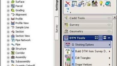
Open CAD Tools, gvSIG editing tools
A series of quite interesting features has been launched, which come from the contribution of CartoLab and the University of La Coruña. gvSIG EIEL implies different extensions, very useful indeed, both for user management from the gvSIG interface, custom forms and automatic validations.

But what struck me most is Open CAD Tools, which in its version 0.2 seems to take up many requests from the community to concentrate and improve the routines of building and editing data.
 If gvSIG has something that we GIS users like are its creation tools in the style that we usually do with CAD programs, it has practically everything that we question about specialized GIS programs. Installing this extension replaces the default extCAD. The user manual explains how to install only the extension, as it also comes as an executable, although with an old version of gvSIG.
The following 11 commands are grouped in the insert option: Point, Multipoint, Arc, Polyline, Multipolyline,, Multitask, Multipolygon, Regular polygon, Rectangle, Circle, Ellipse and Autopolygon.
While in the Modify the following 16 commands: Copy, Symmetry, Rotate, Scale, Explode, Scroll, Edit vertex, Add vertex, Remove vertex, Merge, Redialize line, Cut line, Cut polygon, Redigitalize polygon, Internal polygon and Stretch .
In total 27, of which I remember Have accounted for 21 when doing a comparison of the AutoCAD commands against those of gvSIG 1.9.
 What is the most valuable thing about Open CAD Tools 0.2
For starters, I find the functionality Right mouse button, once a command has been started, it can function as "undo". It seems very practical to me, because when a geometry is being drawn, for example a polyline or polygon, it is common to make a mistake when placing a point; instead of canceling the work done, or continuing to edit later ...
Right button, and the last point placed is erased
Also, there are some keys that help with the job, Like the "tab", which allows you to navigate to a next item. It occurs, for example, when we edit complex geometry, such as a polygon that has holes, or multiple polylines.
Tab key, and takes us to the next geometry
Then there is the space bar To finish the job and the letter C to cancel. While there are those who archaically question the use of the keyboard at this point, as shortcuts in the middle of a command they are still practical.
 The routines to redigitalize line and polygon solve this great limitation when maintaining geometries already created. Although much of this comes with gvSIG, the extension they have made to the routines is very good, for example, when a line or a polygon is cut, the message asking if we want to keep the excess segment.
So replacing the default tools with Open CAD Tools is a viable option. The only tool that is not found is the Line command, as it is created with the Polyline command, understanding that it only has one segment.
Other improvements are in the configuration of snaps properties, in order not to affect the speed of the machine. For this you can modify the number of geometries for analysis, the layers and if the tracking is done only to vertices or edges.
Then the option to activate NavTable automatically when finishing a geometry. With this, the alphanumeric data could be completed in the same line of the production process. Although the biggest highlight of this, is that the completion of the geometry is now an event, so programmers can do other associated tasks:
- As a review of topologies on a spatial basis,
- Lifting a triger announcing the change to the database even though the vector layers are not on a spatial basis,
- Or simply notifying a database that a specific geometry already exists and that it proceeds to report the integrity with respect to tabular data. As may be the case when the file has been digitized but the mapping is slower.
It will not be strange to see this extension in the next version of gvSIG, as we saw it with NavTable. It seems to us a good example, that together with Fonsagua Represent results of the work that the Foundation has been maturing in the formation of that industrial fabric that is one of the strong pillars for the sustainability of the Open Source platforms.
To follow up on this topic I suggest the following links:
http://cartolab.udc.es:30003/menu/la-aplicacion/funcionalidades/
http://forge.osor.eu/frs/download.php/1447/manual_opencadtools.pdf
https://lists.forge.osor.eu/mailman/listinfo/opencadtools-devel
And then this video to see the use of EIEL in the road layout.