
AulaGEO Courses - The best training offer in Geo-Engineering


Sketchup Modeling AulaGEO presents the 3D modeling course with Sketchup, it is a tool to conceptualize all architectural forms ...
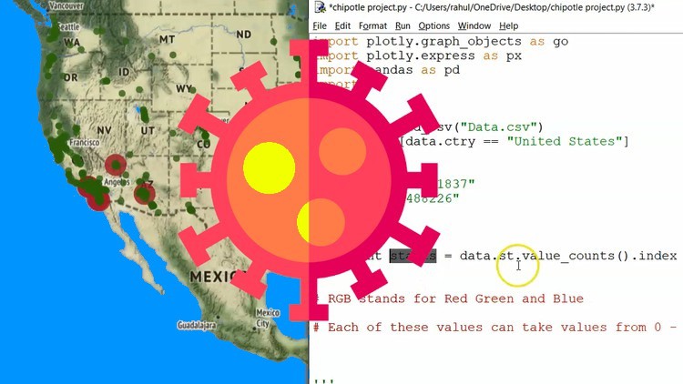
Currently there are many interested in the treatment of large amounts of data to interpret or make correct decisions in all ...

In this advanced course I show you step by step how to implement the BIM methodology in projects and organizations. Including modules ...

Ansys Workbench 2020 R1 Once again AulaGEO brings a new offer for training in Ansys Workbench 2020 R1 ...
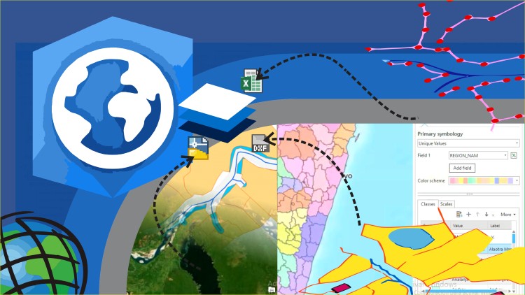
Learn ArcGIS Pro Easy - it is a course designed for enthusiasts of geographic information systems, who want ...
Learn to use advanced features of ArcGIS Pro - GIS software that replaces ArcMap Learn an advanced level of ...

This is a course designed to learn AutoCAD from scratch. AutoCAD is the most popular software for assisted design ...

Learn Autodesk 3ds Max Autodesk 3ds Max, is a very complete software that offers all the possible tools to create ...

We welcome you to the Naviworks environment, Autodesk's collaborative work tool, designed for project management ...

Blender 3D With this course, students will learn to use all the tools to model objects in 3D, through ...

Points, surfaces and alignments. Learn to create designs and basic linear works with Autocad Civil3D software applied to Topography ...
Assemblies, surfaces, cross sections, cubing. Learn to create designs and basic linear works with Autocad Civil3D software applied to ...

Advanced alignments, surfaces, cross sections. Learn to create designs and basic linear works with Autocad Civil3D software applied to ...

Grades, sanitary drains, parcels, intersections. Learn to create designs and basic linear works with Autocad Civil3D software applied to ...
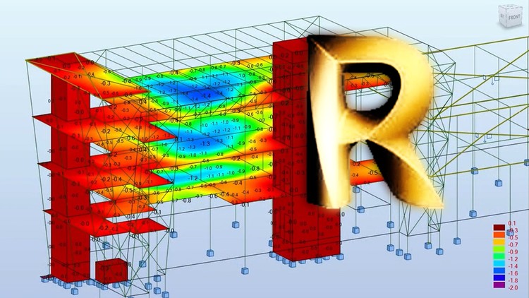
Complete guide to the use of Robot Structural Analysis for the modeling, calculation and design of concrete and steel structures ...
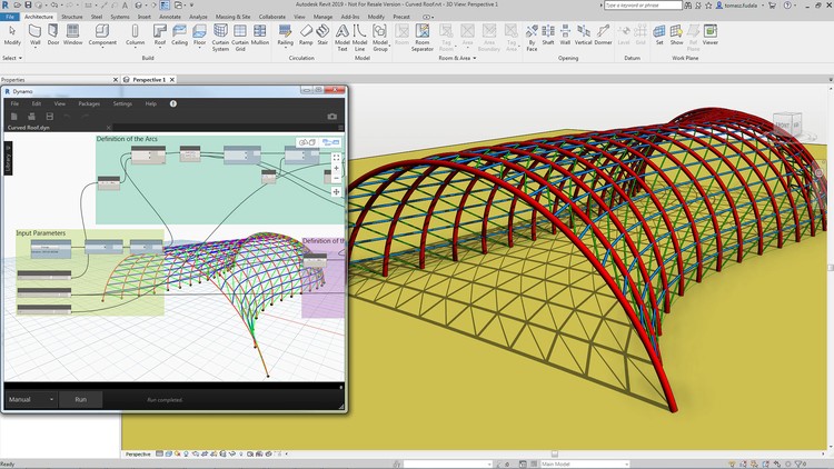
BIM Computing Design This course is a friendly and introductory guide to the world of computational design using Dynamo, a platform ...

Everything you need to know about Revit for creating projects for buildings In this course we will focus on giving you ...

Google Earth is a software that came to revolutionize the way we see the world. The experience of surrounding ...

This is an introductory course to SolidWorks tools and fundamental modeling techniques. It will give you a solid ...

Practical design guide with Building Information Model aimed at structural design. Draw, design and document your ...

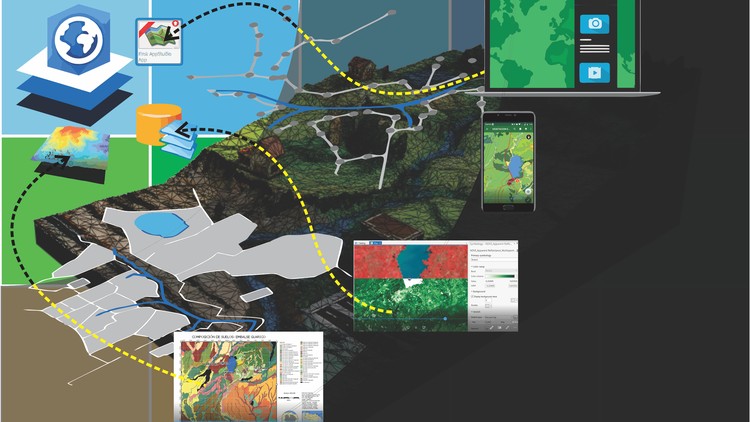
Discover the power of remote sensing. Experience, feel, analyze and see what you can do without being there. The...

Autodesk Inventor Nastran is a powerful and robust numerical simulation program for engineering problems. Nastran is an engine ...

Avenues and flood analysis with free software: HEC-RAS HEC-RAS is a program of the Army Corps of Engineers ...

Create digital models from images, with free software and with Recap In this course you will learn to create e ...

Discover the potentialities of Hec-RAS and Hec-GeoRAS for channel modeling and flood analysis #hecras This practical course ...
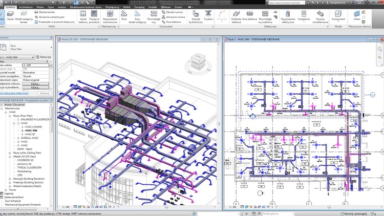
Creation of BIM models for pipeline installations What you will learn Work collaboratively on multi-disciplinary projects that involve ...

In this course we will focus on the use of Revit tools that assist us in performing ...

This AulaGEO course teaches the use of Revit to model, design and calculate electrical systems. You'll learn...

Learn to use QGIS through practical exercises Geographic Information Systems using QGIS. -All the exercises you can ...

Learn to use REVIT MEP for the design of Sanitary Installations. Welcome to this course on Sanitary Installations with Revit MEP....

Each innovation had its followers who, when applied, transformed different industries. The PC changed the way we drive ...

Creo Parametric is the design, manufacturing and engineering software of PTC Corporation. It is a software that allows modeling, ...

Creo is the 3D CAD solution that helps you accelerate product innovation so you can create better ...

CREO is the 3D CAD solution that helps you accelerate product innovation so you can create better ...

In this course we will focus on extracting quantities directly from our BIM models. We will discuss various ways to extract quantities using ...

AulaGEO presents this course focused on the development and interaction of spatial data for the implementation of the Internet ...

Learn design of reinforced concrete and structural steel using Revit Structure software and Advanced Steel Design. Design reinforced concrete ...